
How Do Map Apps Know There Is Traffic Ahead?
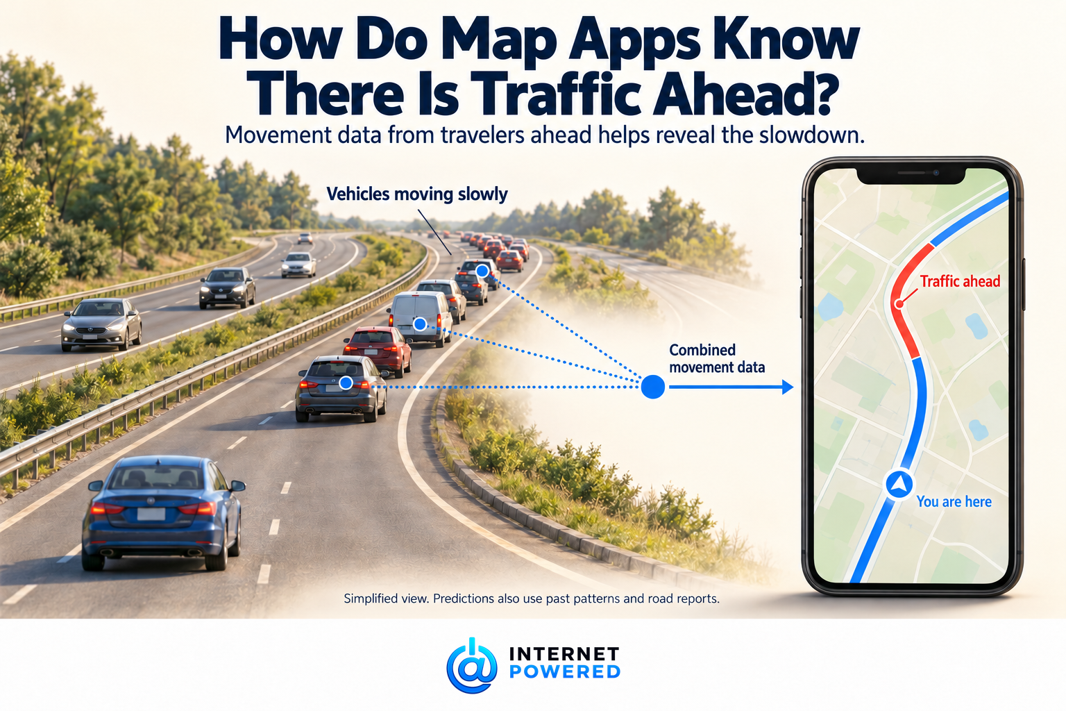
Map apps combine movement data from participating phones and vehicles with past traffic patterns and road reports to estimate where travel is slowing and what you may encounter next.
You are still moving comfortably when the road on your map turns red a few miles ahead. You cannot see a queue. Nobody in your car has reported one. How does the app already know?
A major clue comes from people traveling that stretch before you. Their devices can supply information about where they are and how they are moving. The mapping service turns those observations into estimates of conditions along the road. Your phone can receive that wider picture before you reach the slowdown. Google Maps and Waze both describe using information from navigating users this way. [1][3]
The useful mental model is a road network that is continually being sampled. The app does not need an observation from every car to estimate how a stretch of road is moving. But the size and quality of that sample affect how much it can tell you. [9]
The vehicles ahead supply clues
Google says that while you navigate, Maps collects information including GPS location, the route taken and device sensor data. These observations help provide traffic updates and alternate routes. [1]
Apple describes a related contribution through its Routing and Traffic system service: when enabled, an iPhone in transit periodically sends location, speed and direction information to help improve traffic and other databases. Apple says those transmissions are anonymous and encrypted. Participation depends on the relevant settings; carrying a phone does not mean every device contributes to every map service. [2]
Phones are only part of the possible supply. TomTom describes inputs from connected navigation devices, automotive partners, fleet systems and smartphone applications. Different services can therefore draw on different collections of travelers. [8]
Movement becomes a road estimate
A location reading must first be made useful in the context of a road. Navigation systems use a process called map matching to associate positions with the mapped road network. This matters because a reading can be slightly misplaced, and two nearby roads may run alongside each other. TomTom's documentation explains how road shape and a vehicle's movement help resolve that uncertainty. [4]
Once observations belong to a stretch of road, the important question becomes how quickly travelers are getting through it. Waze says it uses information shared by people driving with the app open to calculate average speed. [3]
Imagine several participating vehicles taking much longer than usual to cover the same stretch. Together, their journeys provide evidence of slow travel. That is an illustration of the principle, not a fixed rule about how many cars an app needs. Providers process observations and filter unreliable data rather than treating every reading as equally trustworthy. [9]
The result can become the colored line you see. TomTom, for example, describes comparing current speed with free-flow speed: how quickly traffic moves when the road is uncongested. Its map displays can represent speeds, or the difference from free flow, using colors. A red stretch communicates slow progress; it is not a count of the cars sitting there. [5]
Knowing traffic is slow is different from knowing why
Movement data can reveal the effect of a problem without identifying the problem itself. Slow journeys alone do not establish whether there is a crash, roadwork or another obstruction. That distinction follows from what the observations measure: movement through the road, rather than a description of the event. [3][5]
Reports add that other kind of information. Waze lets users report accidents and blocked roads. Google describes using driver reports alongside authoritative information from local governments about restrictions and road conditions. These inputs can give context to a slowdown or tell the service that a route is unavailable. Nobody has to submit a crash report before slow movement can become useful traffic evidence. [3][6]
Ahead also means later
There is another complication: a road that is clear now might be busy by the time you reach it.
Google describes combining live conditions with historical traffic patterns to predict what a driver will encounter. Past trips supply evidence about how a road tends to behave at different times; recent observations help the system respond to today. The route calculation therefore has to consider the journey as it unfolds, rather than assuming today's traffic will stand still while you drive. [6]
Roads also affect one another. DeepMind's published account of its work with Google Maps describes a prediction model that represents connections between road segments. That helps explain why travel-time prediction involves more than assigning an isolated speed to each street. The account describes a particular system developed in 2020, not a complete specification of every current map app. [7]
Why the map sometimes gets it wrong
The service is working with incomplete evidence. FHWA notes that the accuracy and timeliness of vehicle-based speed and travel-time data depend on sample size. A quiet road may offer fewer observations than a busy highway. [9]
Position errors can also place a traveler on the wrong nearby road. And even a useful picture of current movement cannot guarantee what happens next: TomTom notes that unexpected events and longer forecasting horizons make prediction harder. [4][8]
These limits explain how you can encounter a new queue before the estimate catches up, or arrive after a reported slowdown has eased. Those are consequences of estimating a changing situation, not proof that the app had a complete view and ignored it.
When your map warns of traffic ahead, read it as an informed estimate. App connected journeys already happening provide clues about the journey you are about to make.
Source Library
[1] How navigation data makes Maps better for everyone. Google Maps Help. Publication date not stated.
https://support.google.com/maps/answer/10565726?hl=en
[2] Location Services & Privacy. Apple. 11 February 2026.
https://www.apple.com/legal/privacy/data/en/location-services/
[3] About Waze. Waze Help. Publication date not stated.
https://support.google.com/waze/answer/6071177?hl=en
[4] Map matching. TomTom, Maps and Navigation SDK for Android, version 2.6.2. Publication date not stated.
https://docs.tomtom.com/navigation/android/guides/navigation/map-matching
[5] Inside TomTom's Traffic products: TomTom Traffic Flow. TomTom Editorial team. 6 September 2024.
https://www.tomtom.com/newsroom/product-focus/traffic-flow-product/
[6] Google Maps 101: How AI helps predict traffic and determine routes. Johann Lau, Google. 3 September 2020.
[7] Traffic prediction with advanced Graph Neural Networks. Oliver Lange and Luis Perez, DeepMind. 3 September 2020.
https://deepmind.google/blog/traffic-prediction-with-advanced-graph-neural-networks/
[8] What is traffic prediction and how does it work? Joao Laranjeira, TomTom. 24 January 2020 as displayed.
https://www.tomtom.com/newsroom/behind-the-map/road-traffic-prediction/
[9] Frequently Asked Questions. Federal Highway Administration, Crowdsourcing for Advancing Transportation Operations. Last modified 14 February 2025.
https://ops.fhwa.dot.gov/crowdsourcing/faq.cfm
All sources accessed 8 October 2026.